OUTWELL AND UPWELL
These two villages lie astride the Well Stream. Each is therefore partly in Norfolk and partly in the Isle of Ely. (fn. 1) In the Middle Ages they were collectively known as 'Welle' or 'Welles', and today they are absolutely continuous, so that it is impossible for a stranger to tell where one ends and the other begins. Together they stretch about 4 miles along the old course of the Nene, and are locally considered, probably with truth, to be 'the longest village in England'. They also form a very large village community. In 1931 the population of the four constituent parishes was just under 5,000, though the area (some 20,000 acres) is also considerable.
In the Middle Ages the Nene dictated the lay-out of the villages, but the topography of the whole district has subsequently been much altered by several large drains which run through these and neighbouring parishes. Such are Popham's Eau, an early 17thcentury cut to guide the waters of the old Nene into the Ouse at Salter's Lode; the Old Bedford River (part of the south-east boundary of Upwell), the main drainage channel, with the New Bedford River, of the southern fens; and the Middle Level Main Drain, which takes the outflow from the Chatteris and Doddington areas diagonally across Upwell and Outwell to the Ouse at the Wiggenhalls. The bursting of the bank of the Middle Level Drain in May 1862 inundated one-sixth of the parish of Outwell, which had not fully recovered three years later. (fn. 2) With these waterways may also be numbered the Wisbech Canal, now disused, which followed the course of the Well Stream as far as Outwell church and then struck across in a southeasterly direction to join Popham's Eau at Nordelph (formerly a hamlet of Upwell but now a separate Norfolk parish), about 3 miles east of Upwell and Outwell.
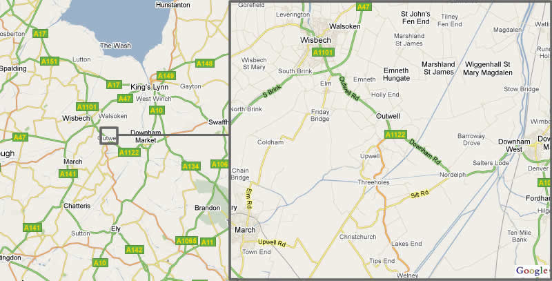
As befits a former market-town, (fn. 3) Upwell is something of a road centre. There is the main road from Wisbech to Downham Market (A 1122) following the canal; the Wisbech-Ely road (A 1101), which leaves this at Outwell church; a second-class road to Chatteris (B 1098), which follows the Sixteen Foot Drain (a continuation of the Middle Level Main) from the south end of Upwell village; and another from Nordelph (B 1094), which takes a very circuitous course through Christchurch, the southern hamlet of Upwell, to Manea and Wimblington. The Upwell steam tramway from Wisbech, a light railway of 4 ft. 8½ in. gauge, was opened by the G.E.R. in 1884; (fn. 4) it conveyed passengers until 1928, and is still used for goods traffic. It forms an unusual feature in the landscape, and running for much of its course along the high road, is to some extent responsible for the very pronounced ribbon development which has made the road to Wisbech (via Emneth) a built-up area almost continuous for the 7 or 8 miles of its course.
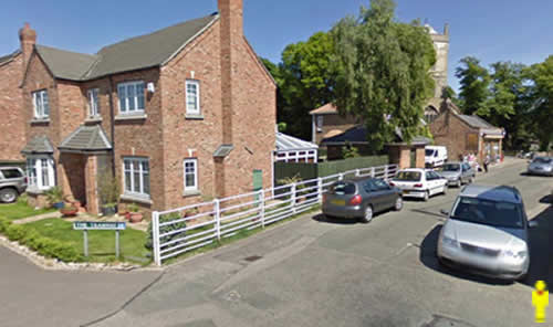
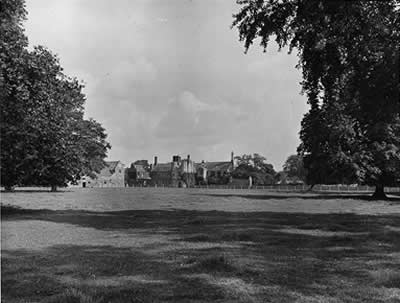
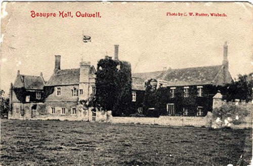
Except for the two churches, Beaupré Hall (the former chief manor house), the Upwell Baptist chapel (1844), James Lee's Almshouses (1819), and the modern Secondary and Beaupré Primary schools, the buildings of the villages have individually no great architectural distinction. They form, however, pleasant groups fronting the water-courses, and Upwell has been illustrated at least twice in books on the English countryside. (fn. 5) William Watson's description, written over a hundred years ago with reference to Marshland villages in general, is still applicable to these two in particular. 'The pale brick and tile', he says, 'manufactured in these parts, give a very neat appearance to the houses... and though the country cannot boast of rural beauty, there is an air of neatness and of greater comfort than... in many other agricultural districts.' (fn. 6) It was unfortunate that soon after he wrote, Upwell was one of the places most severely attacked by the 1832 cholera epidemic, 67 persons dying here and in Nordelph in less than two months. (fn. 7) The district was already known for its market-gardens in the 1830's— some time before they became general in Marshland. (fn. 8) As elsewhere in the north of the Isle, inclosure mostly took place gradually as the land was reclaimed and drained, but Outwell was affected by the Act of 1841 (fn. 9) (see also Leverington and Tydd St. Giles), under which Cottons Common (98 acres) and 15 acres of waste land were inclosed. By this inclosure 2 acres were set aside for a recreation ground, the Bishop of Ely as lord of the manor was allotted 1¼ acre, 17 acres were sold to defray costs, and the remaining 93 were divided amongst 26 proprietors, of whom James Lee (14 acres) was the only one to receive a holding of any size.
A public hall was erected at Upwell by a limited liability company in 1868 and is still in use. (fn. 10) The Outwell Working Men's Institute at Outwell dates from 1891, though the building is not now used for its original purpose. A Gas Company was formed in 1867. (fn. 11) Outwell was probably the birthplace of Robert Wells or Steward (d. 1557), the last Prior and first Dean of Ely. (fn. 12)
From: 'Wisbech Hundred: Outwell and Upwell', A History of the County of Cambridge and the Isle of Ely: Volume 4: City of Ely; Ely, N. and S. Witchford and Wisbech Hundreds (2002)
Outwell: Pigots Directory 1839
|